GPS Track allows you to give OSS-ESPA access to your current location from your OTA vehicles and GPS trackers. This location data is then displayed as a breadcrumb trail on the Sentinel screen where your movements can be monitored. This allows monitors to determine your position relative to a point of interest, such as a location or a suspect. It also allows them to monitor areas you and other personnel are searching, which means they can direct people to useful search areas and avoid multiple people searching the same areas.
How do I assign a GPS slap-on tracker to a GPS track account?
Assigning a GPS slap-on tracker to a GPS track account
GPS Track licenses are available individually and a license is required for each assigned GPS tracker.
Gladiator Forensics currently supports the API for Covert Track.
Covert Track charges their users for API access.
Once you have API access, go to your Covert Track account settings and Enable RSS.
Create a Gladiator support request and attach the device ID (or name), the regular feed URL and the GeoRSS simple feed URL for each device.
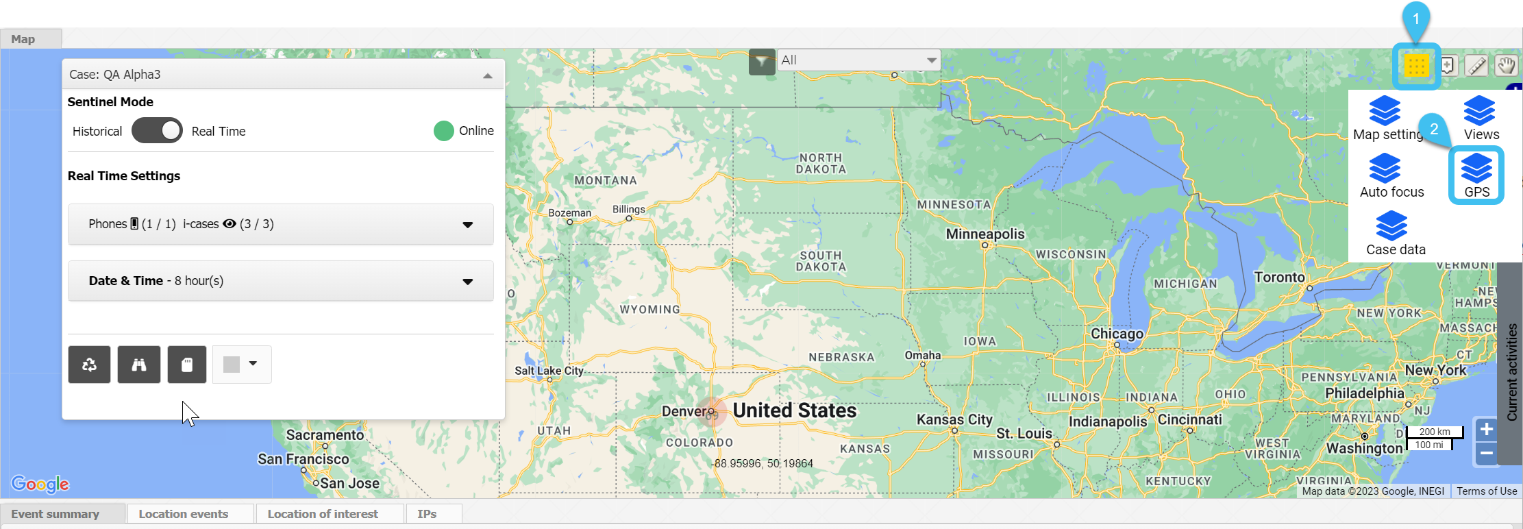
How do I display GPS units on the Sentinel screen?
How to display GPS Tracker and field units on the Sentinel screen
Open the Sentinel screen. This screen can be opened in a number of ways, for example:
If you are on the Advanced view cases screen, in the Actions column click to open the Sentinel screen.
If you are on the View i-cases screen right click either a case, person, phone number or i-case and select Open Sentinel view.
If you are on the Manage case screen for a case click which is at the top-right of every screen to open the Sentinel screen.
On the Input and Settings view, set Sentinel Mode to Real time.
On the Map view select then .
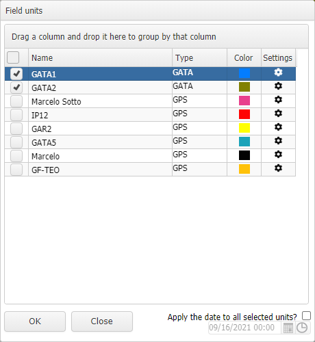
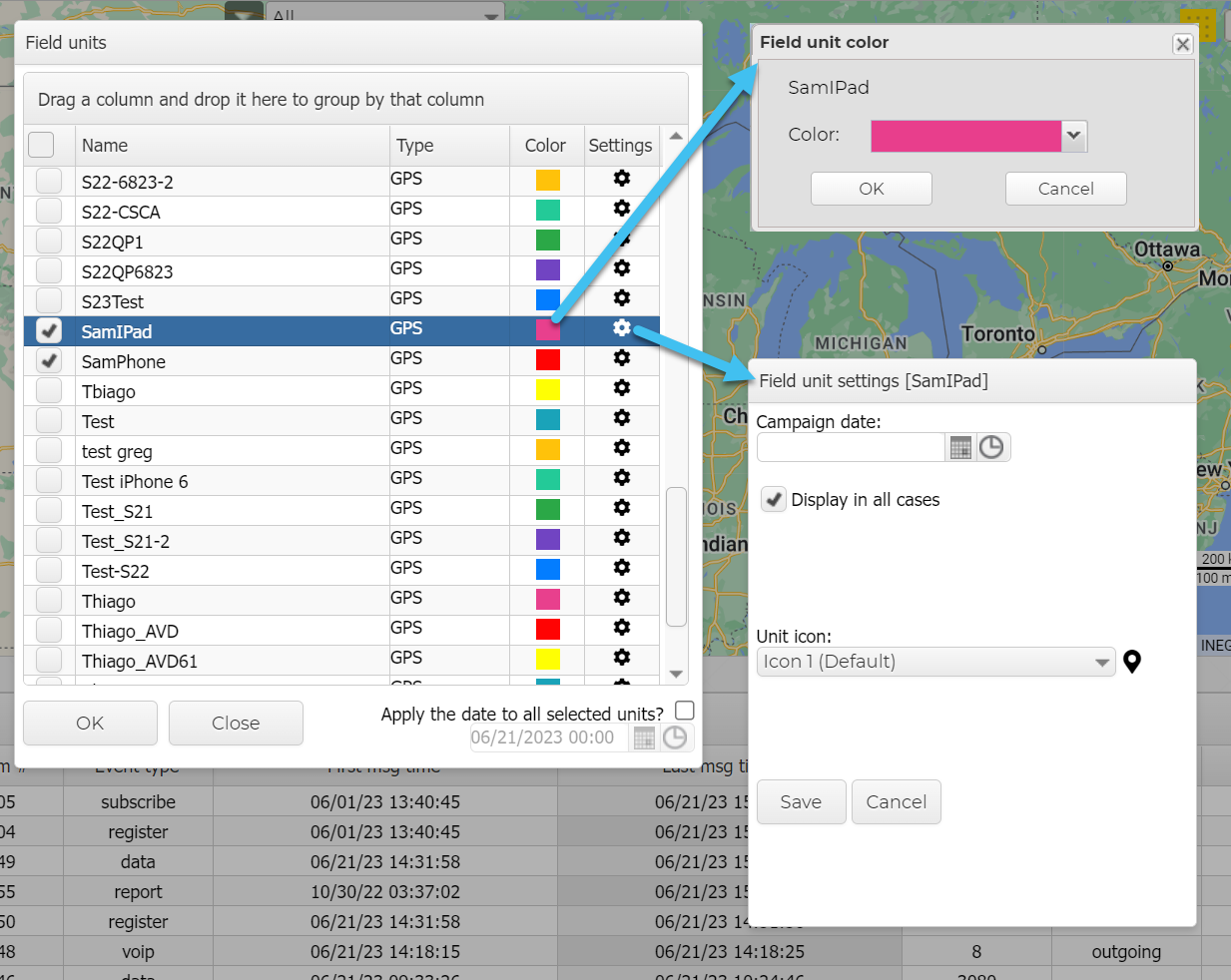
The Field units dialog box opens.
Using the check-boxes, select which units you want to view.
Optionally, if you want to:
change the color used to display the field unit click the colored square and select a new color.
enter a campaign date and change the display icon click .
Click Close.
Click the GPS tracker view.
All the field units which you selected to view that are currently active, are displayed on the GPS tracker view. You can then use the check-boxes on this view to select which field units you want displayed on the map and what details you want displayed, such as its breadcrumb trail.
Click Zoom to center a unit on the map; displaying its current location, and its previous locations.
 Using GPS Tracker
 to open the
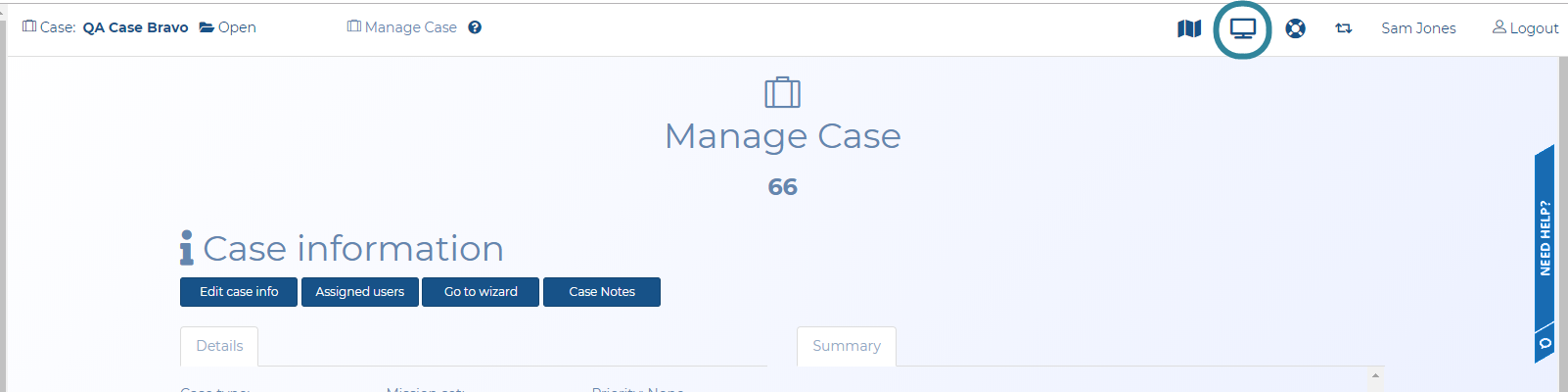
 then
then  .
.